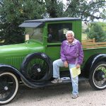
Donald County Park has a diverse environmental and cultural history, with artifacts found dating back 13,000 years. The park was established in 1993 with a gift of 105 acres from Delma Donald Woodburn’s family and in 1996, Dane County acquired the Hitchcock property. Pat Hitchcock was one of many Friends of Donald Park volunteers with cultural ties to the land that makes up the park, and she worked tirelessly as a volunteer. The park now covers more than 700 acres and is truly a shining star in the Dane County Park system.
Geology
Paleo-Indians
Early Settlers & Farming
Foye Cabin
The Donald Property
The Hitchcock Property
Women Founders
 Natural History of Donald County Park
Submitted by Chuck DeMets, Professor of Geology and Geophysics, University of Wisconsin–Madison
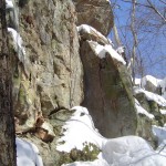
Throughout the four seasons, the slow geologic processes of erosion and weathering silently sculpt the rolling hills and valleys of the Mount Vernon countryside, as they have without interruption for the past 450 million years. Unlike much of the remainder of Dane County and Wisconsin, whose landscapes and soils were profoundly altered by continental ice sheets (glaciers) that periodically advanced south from the Hudson Bay region over the past 2.5 million years, Donald County Park has been shaped by largely non-glacial processes. Donald County Park lies near the edge of the “Driftless Area,” which is a ~10,000 square mile island in southern Wisconsin that has by chance never been overrun by glaciers. As a result, the Donald County Park area lacks the deep deposits of glacially transported sediments and glacial landforms so characteristic of other areas in the state. The geologic evolution of the Donald County Park must instead be studied in a non-glacial context, one whose origins date back to the Cambrian period approximately 500 million years ago. View a map of glaciated Wisconsin HERE.
Between 550 and 450 million years ago, shallow continental seas advanced and retreated five times across much of the central United States, including southern Wisconsin. After each regression of the sea, flat lying marine sediments such as sandstones and dolomites were left behind. When seas retreated for the final time, over 100 feet of sandstones, dolomites, and shales (mud-based rock) had been deposited in the park. The final retreat of the seas left behind a largely flat continental landscape that gradually took shape through the everyday processes of water and wind erosion. Stream valleys and ridges in southern Wisconsin began evolving into their present state, and soils formed through the mechanical and chemical weathering of the rock surfaces. Deer Creek, Fryes Feeder, and Mount Vernon Creek all eroded down through the upper, younger rock layers, and the Platteville and Galena dolomites into the older St. Peters Sandstone beneath. Donald Rock, near the intersection of Town Hall Road and Highway 92, is an erosion-resistant block of St. Peters Sandstone that became isolated as more erodible surrounding sandstone was carried away by water action over many millions of years.
Since 2.5 million years ago, when the edges of large continental glaciers approached the Mount Vernon area, the two most profound influences on the landscape of the Mount Vernon area have been humans and glaciers, in that order. Before ~13,500 years ago, the local environment was nearly identical to that in northern Alaska today. The ground was permanently frozen several feet down. The upper soil layer thawed only for a few weeks each year and tended to slide down slopes rapidly due to its muddy character. The local ice sheet dammed the outlets of nearby streams, leading to small glacial lakes that backed up into the valley of Mount Vernon creek and its tributaries. In some instances a several inch thick layer of light-grey clay was deposited at the bottoms of these lakes and can still be found several feet beneath the valley floors. Plant pollen samples recovered from lake sediments in Dane County indicate that plant life consisted mainly of a treeless tundra with low shrubs and grasses. Since ~13,500 years ago, the local vegetation evolved to a spruce forest as the ice sheet retreated. The bones of woolly mammoths, mastodons, giant beavers, and other large mammals indicate that the local environment supported a rich wildlife population.
After man arrived in central North America some 11,500 years ago, large mammals became extinct, presumably due to overly efficient hunting techniques. The local vegetation evolved to a mixture of prairie and oak woodlands by 10,000 years ago, at which point the continental ice sheet had retreated to the southern edge of Lake Superior. The Donald County Park landscape had almost certainly assumed its present form by this time.
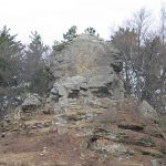 Donald Rock
Donald County Park is in the “driftless area” of Wisconsin that was never covered by later glaciers. Water and wind erosion have sculpted this landscape into the hills and valleys that we see today. Donald Rock is an erosion-resistant block of St. Peter Sandstone that became isolated as the softer sandstone around it eroded, after the continental seas retreated 450 million years ago. The rock was an important landmark to native cultures, especially the Ho Chunk, who visited the valley in pre-European settlement times.In 1952, the family of Delma Donald Woodburn donated the rock, then known as “picture rock,” and two surrounding acres to the Wisconsin Department of Transportation, to serve as a scenic wayside. The rock was renamed Donald Rock in recognition of the family’s gift. The rock has been called the “Preacher’s Cap,” a name that was used by settlers in the 1800s.
Paleo-Indians
There is evidence of human occupation in what is now Donald County Park that spans over 13,000 years of history.
This is amazing. The rich natural resources of Donald County Park must have attracted PaleoIndians, Native Americans, and European settlers alike. The Friends of Donald Park formed a group of volunteers to research and conduct field studies to help reconstruct the cultural history of Donald County Park. The study results and research findings will be used for education materials and interpretative signs at the Park. We are also interested in publishing a book on the History of Donald County Park.
Our journey starts with a Clovis point found in an old field at Donald County Park that dates back to the Ice Age Era.
An artifact found at Donald County Park was identified as part of a broken pre-historic Clovis projectile point. Dave Braun found the artifact while walking around in the crop fields in the park several years ago. Robert Birmingham, retired State Archeologist, and colleagues confirmed it is a Clovis point. This Clovis point is estimated to be about 13,000 years old. It is made from Burlington chert from southwest Illinois or Missouri, according to the scientists that examined the point. Finding a Clovis point is extremely rare and may indicate that Ice Age Era PaleoIndians once roamed these stream valleys to hunt large game like mammoths and mastodons.
Private arrowhead collections of former Park land residents and neighbors illustrate occupation by Native American Societies going back in time to over 10,000 years. Professional Archeologist Robert Birmingham inspected several of these local collections and discovered many different kinds of arrowheads and projectile points. He and volunteers continue to catalog and interpret the origins of these artifacts. This study will aid in understanding the pre-history of the Park.
Excerpts from Mr. Birmingham’s study results (2007): Early Woodland (500 B.C-100 B.C.): “Like the Late Archaic, the Early Woodland is marked by mobile hunting and gathering but with longer warm weather camps or villages. Short term use of Donald County Park is indicated by the presence of Waubesa Contracting Stem point or points found at the park.”
Late Archaic (1,500-500 B.C.): “As elsewhere, artifacts representing this stage are common, reflecting growth in populations with a highly mobile, hunting and gathering way of life. The first mound building begins at the very end of this stage. Long distance trade networks continued to develop, linking people here to other places in North America as reflected by the Indiana chert Turkey Tail point in the Henderson collection. Burial mounds appear at the end of this stage. Late Archaic material is common in the area, and in Donald County Park, a base of one Durst point collected in the Park indicates use during this time.
Early Settlers & Farming
The Mount Horeb Area Historical Society has a wealth of information about this time period.
The first government surveyors in this region during the early 1830s made maps showing that the lands which make up Donald County Park were predominately prairies with oak forests on the hills. John Mullet was the 1883 government surveyor who recorded land features and created the early maps for this part of Dane County.
Download the 1833 map of Donald County Park HERE.
Charles Gerhards, a member of the Friends group, has done extensive research into the early cabin and farmstead sites in Donald Park. Mr. Gerhards’ research indicates that there are several settler era cabin sites in the park. One can still see the cellar foundation for one of these cabin sites. The State Archeologist, John H. Broihahn, visited the park and recommended that we preserve and protect these sites. Accordingly, Mr. Broihahn registered the Foye Site and the Byam Site both at the park in the Wisconsin Archeological Site Inventory. See Foye Cabin below for more information.
Historic Little Spring Cabin Site
“You can’t have a future without a past.” — Delma Donald Woodburn
History Committee – Cabin Restoration
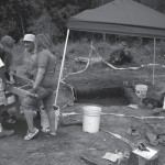
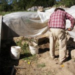
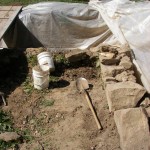
Matt Marty heads a group of volunteers who have been meeting on Tuesdays working to restore a cabin site in Donald Park. In 2008 they started a project which involved the history of the park. A farm house burned down in the spring of 1893 and the foundation of that house was rediscovered and folks thought it would be interesting to find out what was left behind after the fire. They received support from the Mount Horeb Community Foundation to do a dig and they found many interesting artifacts. They have continued with the dig and have a goal of rebuilding the foundation and someday will put a log cabin on it, just as it was in 1893. Many people have participated over the years and there is still a need for more volunteers. The 2012 goal was to excavate the burn layer and then prepare for the foundation reconstruction. The excavations began in spring 2012 with our archeologist Bob Birmingham leading the dig. If you would like to be involved please email Matt Marty at marwigs@chorus.net.
Cabin site update 10-2012: By Matt Marty
The Cabin Foundation at Little Spring is Reconstructed
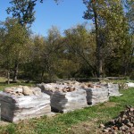
After 119 years, the foundation for the cabin at Little Springs (Foye Cabin) has been rebuilt and is in one piece again. The original cabin burned to the ground in the spring of 1893 and over the next century the remaining foundation slowly crumbled into the hole. The foundation for the original cabin at Little Spring was constructed by the Foye family in or about 1853. It was built from stones which were more than likely gathered from the land and hills in the area. They were just found on the surface as remnants of the erosive forces which formed the beautiful bluffs which we enjoy today. There is no evidence of a stone quarry from which they would have been mined. A total of 29 tons of stone were used in the reconstruction and about 70 percent of that was from the original foundation. The other stones were given to the park by David Whitman of Plain, Wisconsin. The vast majority of the reconstructed foundation was built from sandstone. the reason for this was to increase the strength because limestone and sandstone react differently to moisture and temperature. By building the new foundation with sandstone only, it will be able to better withstand the forces of freezing and thawing. The earlier foundation was built with a mix of and and limestone because that was what was available at the time.
Art Kirch of Kirch Masonry of Barneveld began bringing in materials for the foundation on September 6, 2012. These materials and equipment included sand, mortar, a bobcat, mortar mixer, forklift, and water. A total of 80 bags of mortar and 12 yards of sand were used on the project. Water was also hauled in by 50 gallon drums while a little was procured from Little Spring. The mortar was interesting in that Art consulted with Jim Sewell of the State Historical Society for the proper psi (850 pounds per square inch) strength of mortar to use with sandstone. The mortar shouldn’t be harder than the stone it is holding together because it will break the stone if it is put under stress. The mortar was custom made by the Western Mortar Company.
Art did not build these walls by himself. He was assisted by his mentor Richard Amble a master mason also from Barneveld. Richard and Art have a business relationship where they often assist one another in various projects. there were also two mason tenders. Jared Vinje of Daleyville, who has been with Art for 9 years and is also an apprentice mason. The other tender was Miles Rolli of Jonesdale who has been with Art for 3 years. Mason tenders do a variety of tasks: they mix the mortar, deliver it to the masons on their boards, deliver rocks, move the mortar boards, and generally keep the mason supplied with all the materials they need. The entire job took a total of ten days and Art is very pleased with the results. He isn’t the only one pleased with the reconstruction. I can’t believe the number of people who have stopped by and expressed their admiration for the beautiful stonework. It is so striking it almost takes your breath away. It will be kind of a shame to cover them with whatever we decide to put on that foundation.
Pre-Settlement
Township history books tell of a pre-Statehood pioneer by the name of George Patchin building the first log cabin in the area near the Big Spring which is adjacent to Donald Park and the cabin site may be within Donald County Park. We have European settlers moving into the stream valleys of Donald County Park during the mid-1800’s that have farmed the same land for generations.
The first government surveyors in this region during the early 1830’s made maps showing that the lands which make up Donald County Park were predominately prairies with oak forests on the hills.
Funds from a grant by the Mount Horeb Community Foundation supported Rob Nurre to play the part of the “Surley Surveyor”. Rob entertained and educated the crowd of park patrons about John Mullet, the 1883 government surveyor that recorded land features and created the early maps for this part of Dane County.
Charles Gerhards, a member of the Friends group, has done extensive research into the early cabin and farmstead sites in Donald County Park. Mr. Gerhards’ research indicates that there are several settler era cabin sites in the park. One can still see the cellar foundation for one of these cabin sites. The State Archeologist, John H. Broihahn, visited the Park and recommended that we preserve and protect these sites. Accordingly, Mr. Broihahn registered the Foye Site and the Byam Site both at the Park in the Wisconsin Archeological Site Inventory.
The foundation of the Foye Cabin near the Little Spring appears to have been built in the 1850s. Restoration of the Foye Site began thanks to a grant from the Mount Horeb Community Foundation and the work of The Friends of Donald Park volunteers. This cabin cellar may have been built at about the time of Statehood. The cabin burned down in the late 19th century, according to Township history accounts, and now the cabin foundation — constructed of stacked limestone — is being excavated and restored. We hope to confirm the history and origin of the site, and to preserve any recovered artifacts. Volunteers are clearing away the overgrown trees and under the supervision ofretired State Archeologist Robert Birmingham, will stabilize the cellar foundation and conduct public workshops on archeology methods to study this site.
Excerpts from Mr. Gerhards’ research results (2007):
Foye Properties: “On Dec 9, 1854, John Foye and Joseph Wright of Waukesha County, Wisconsin, paid Lawrence Smith and his wife, Susan, of Dane County $845 for the SW NE Quarter of Section 33 containing 40 acres. This land included an existing house. On the same day John Foye and Joseph Wright of Waukesha County, Wisconsin paid Lawrence Smith and his wife, Susan, of Dane County $845 for 36 acres of land by separate deed from the 40 acres described as follows: commencing at the NW corner of NE SW Quarter of Section 33, thence east to the NE corner of NW SE Quarter, thence south 8 rods, thence west 20 rods, thence south westerly in a direction to run 3 rods west of the house and far enough to include 36 acres of land by running west to the west line of the NE SW Quarter of the same section, thence north to the point of beginning. It is likely that the $845 was for both the 40 acres and the 36 acres. Also on the same day John Foye, Mary Foye, Joseph Wright and Mary Wright, of where not stated, executed a mortgage of $620 on the property sold to them by Lawrence Smith who held the mortgage. This land was erroneously described as follows: NW NE of Section 3 and the SW NW of Section 23,commencing at the NW corner of NE SW of Section 33, thence to the NW corner of NW SW SE, thence south 8 rods, thence west 20 rods, thence south westerly in a direction to run 3 rods west of the house and far enough to include 36 acres of land by running thence west to the west line of the NW SW to the place of beginning. On Nov 24, 1860, Lawrence Smith acknowledged that the mortgage was satisfied in full.”
Download the 1833 map of Donald Park HERE.
The Donald Property
The Genesis of Donald County Park was created when Dane County acquired large portions of two farm properties straddling State Highway 92, between Mt. Vernon and Mt. Horeb–the Donald farm and the Hitchcock farm.
James Donald’s grandson, John Sweet Donald, eventually took over the family farm operation, which had expanded due to the acquisition of nearby farms.John and his wife Vona became involved in progressive politics, and he served in the Wisconsin State Senate and as Secretary of State.Eventually, John joined the faculty of the University of Wisconsin College of Agriculture, while continuing to help manage the farms.
Delma Donald, John and Vona’s daughter, earned a B.A. in Economics from the University of Wisconsin in 1921.She later married James Woodburn, an engineering professor, whose job took the family to several states and to Germany. Nevertheless, Delma remained deeply interested in the history of her family and of Donald Farm.
In 1993, the Woodburn family donated 105 acres of the Donald property to Dane County Parks, the nucleus of what is now known as Donald County Park. Over the next fourteen years, the County acquired an additional 475 acres of the family’s property through a combination of purchases, easements, and donations.
Delma Donald Woodburn died in 2001 at the age of 102. Her sons Bob and Jim have continued to be enthusiastic and generous supporters of the Park.
The Hitchcock Property
The Genesis of Donald County Park was created when Dane County acquired large portions of two farm properties straddling State Highway 92, between Mt. Vernon and Mt. Horeb–the Donald farm and the Hitchcock farm.
Unlike the Donald land, the land that became the Hitchcock farmstead changed hands frequently after it was first purchased by Christian Summerdale in 1841. In 1967, Pat Hitchcock and her husband John, an anthropology professor at the University of Wisconsin,bought the property from Harold Larson, whose family had owned and farmed the land since 1945. Pat and John connected closely with the land. They became involved in chemical free farming; John loved riding horses; and Pat organized a curriculum for a Christian outreach program called Young Life that involved cross-country skiing, hiking, and maple sugaring.
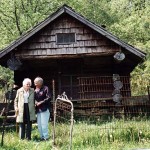
In 1996, the County acquired the Hitchcock property, with the provision that Pat could lease it back during her lifetime. Over time, the lease was limited to the farm buildings, including the home that Pat occupied until her death in 2009 at the age of 89. After Donald County Park was established, Pat continued as perhaps the most active volunteer in The Friends of Donald Park.
 Women Founders
Two farsighted, unrelated women, Delma Donald Woodburn and Pat Hitchcock,
became neighbors and then partners in providing land – and vision – that formed Donald County Park.
 Delma Donald Woodburn, major contributor to the creation of Donald County Park
Brian Bigler of the Mount Horeb Area Historical Society interviewed Delma before her death and wrote a short biography of this special lady.
Delma Donald Woodburn, a Donald County Park Founder by Brian Bigler
Delma Donald Woodburn was born June 2, 1899, in Springdale Township to John Sweet Donald and Vona DeCrow Donald, she spent her early years on the farm which her great-grandparents, the Rev. James Donald and Margaret Strong Donald, established in 1855. A self-described “tomboy” who loved outdoor play, climbing the farm’s huge oaks, getting together with neighbor kids, playing with her dog, and tending her favorite pony, “Flashlight,” whom she named after its invention, Delma attended grade school at the nearby Malone School. The young girl’s job each Saturday was to clean the farm home’s many lamps and chimneys, help card horse hair for mattresses and, when old enough, tend the livestock. Delma spoke often of the early deaths of her only siblings, Robert, who lived for just a few weeks in 1901, and especially her sister Dora, born June 3, 1903, who lived six months.
Delma was raised in a politically active household. Her father served in the State Assembly from 1902 to 1907, the Senate from 1908 to 1911, and spent two terms as Secretary of State from 1912 to 1916. These were the years of Progressive legislation and Delma recalled visits from such political notables as Robert and Belle Case LaFollette and the famed architect Frank Lloyd Wright. Her mother, Vona, was interested in the causes of the day, including the Women’s Christian Temperance Union (W.C.T.U.) and progressive ideas on rural education which she championed while at the farm and later after the family’s move in 1917 to 211 Prospect Avenue in Madison. In 1920, at age 21, Delma voted in the first election for which women had achieved this right.
Delma spent her high school years at Madison and was one of the first graduates of Wisconsin High School. She received her B.A. in Economics from the University of Wisconsin in 1921. Delma married James Woodburn on December 1923. James’s career as a professor of civil and hydraulic engineering took them to Pullman, Washington, Ann Arbor, Michigan and Germany. Amid these moves Delma studied home economics for a semester at Indiana University in 1924 and earned a degree in a farm short course at the UW College of Agriculture from 1938 until 1940. She also gave birth to two sons, James Donald Woodburn in 1925 and Robert Donald Woodburn in 1928. In 1937 Delma and James moved into the family home at 211 Prospect. James passed away in 1980.
Never one to sit idle, after her father died in 1934 Delma assisted her mother in the maintenance of their three contiguous farms in Springdale, including the one on which she was born, as places to give young farmers a start. She continued to oversee the Vernon Valley Farms, eventually with the aid of her sons and grandchildren, throughout her life. Area residents knew Delma best through her involvement as a life member in the Friends of Donald Park and the Mt. Horeb Area Historical Society.
The Donald Park Friends group emerged after Delma and her family contributed some of their farmland to Dane County for a park near Mt. Vernon, which the County has subsequently expanded. From around the United States, Delma’s family remains actively involved in the Friends group, which in recent years has volunteered its assistance with projects to expedite the park’s opening to the public.
Delma Donald Woodburn, at age 102 and a half, passed away at her Madison home Nov. 8, 2001. Her Legacy lives on through The Friends of Donald Park, as well as the Mt. Horeb Area and Dane Country Historical Societies.
* This article was reprinted from the Mount Horeb Area Historical Society’s newsletter, Past Times, January 2002.
 Pat Hitchcock
Land contributor, visionary and active volunteer in The Friends of Donald Park.
Unlike the Donald Land, the land that became the Hitchcock farmstead changed hands many times after it was first purchased in 1841. Pat and her husband John, an anthropology professor at the University of Wisconsin, bought the property. Pat and John quickly connected with the land. They became invovled in chemical-free farming. Pat organized a curriculum for a Christian outreach program called Young Life that invovled cross-sountry skiing, hiking and maple sugaring.
In 1996, the County acquired the Hitchcock property, with the provision that Pat could lease it back during her lifetime. Over time, Pat’s lease was limited to the farm buildings and her home that she occupied until her death in 2009 at the age of 89. After Donald Park was established, Pat continued as perhaps the most active volunteer in The Friends of Donald Park at it’s conception. She was a visionary, an energetic worker and was instrumental in calling in volunteers to create what is now Donald County Park.
A Tribute to Pat Hitchock By Mary Spaay – 2008
“We can do this!” That’s the spirit of Pat Hitchcock. From early adulthood, she has had this attitude, doing all sorts of notable things. If you had known Pat in her youth, you would have seen her growing up on a farm and being inspired by Amelia Earhart’s speech at her high school. She drove her Indian motorcycle cross country, studied at a dude ranch in Wyoming, worked on a degree in outdoor education – offered for the first time by the University of Massachusetts and became a state park ranger – one of the first women to do so!
Pat earned money at an aircraft factory so she could head overseas to France with the Red Cross at the end of WWII, then returned home to promote the international aspect of youth hostelry with a 12,000-mile bicycle trip across North America. Among her many inspirations was meeting Earnest Thompson Seaton, a founder of the Boy Scouts of America.
Later, Pat married, had children, spent 4 years in Nepal and, together with her husband in 1967, found the perfect farm in Springdale Township, close enough for him to commute to the University of Wisconsin–Madison. True to her belief in outdoor education and her dedication to involving young people with the natural world, she began making trails, planting pine trees and encouraging youth groups to gather at the farm for activities.
Eventually, Pat’s can-do spirit and her idealism for public lands led her to bring people together to build Donald County Park. Pat is very considerate of her impact on the land, always preferring the quiet outdoor sports –hiking, canoeing, camping, horseback riding, cross country skiing and snowshoeing. Her belief in the value of such activities helped shaped Donald County Park’s master plan and is often reflected in her suggestions to the Friends of Donald Park Board of Directors, on which she has served since the Friends’ inception. In addition to serving on the Board, Pat is the Friends’ Natural Areas Volunteer Coordinator and has input on diverse committees and projects. She works closely with the County Parks staff, as well as with Scouts and other youth groups.
Today, Donald County Park is literally Pat’s home. In 1997, an agreement with Dane County made her 160-acrefarm part of the original Donald County Park lands. She continues to live in the original farmhouse with access to the outbuildings, most of which are offered back to the Friends for equipment storage and meeting locations. The number of hours Pat spends annually enticing volunteers to share and care for the land is unbelievable. I feel the main reason Pat is so successful at getting volunteers to work at Donald County Park is the way she treats them with “gentle” reminders via phone (and more recently, through emails), works right alongside them, makes sure they are well fed and able to socialize during work sessions, and always thanks them for coming and contributing their labors to the park. Her energy, hospitality and commitment to share are known far and wide. So when Pat asks if you’ll be coming to work with a group, just know that she works harder than anyone. Say “YES” if you can!
Pat Receives Individual Achievement Stewardship Award. In May, Pat was one of four conservation leaders honored by the Natural Heritage Land Trust at the organization’s 25th anniversary celebration. She received the Individual Achievement Stewardship Award for her exemplary role in the stewardship of Donald County Park. She was nominated by Becky Olson, Executive Director of the Upper Sugar River Watershed Association. Congratulations, Pat — we are so proud of you!
